Shadowmap: Sunlight & Shade
- 0.0
- Rating
- 10.00K
- Installs
- Free
- Price

 Analysis by App-foxy
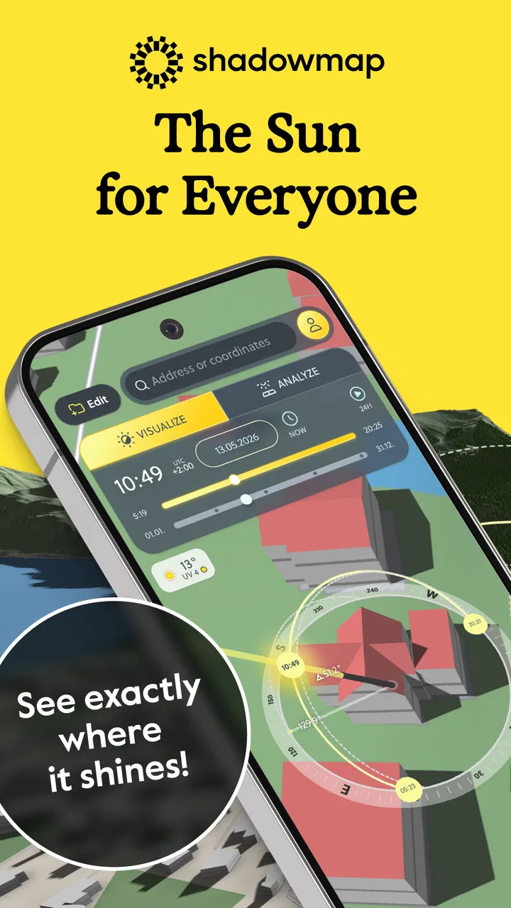
When I need to understand how sunlight will move through a place, an ordinary weather forecast is not enough. Forecast apps tell me about clouds, temperature, and rain, but they rarely answer the practical question I actually have: will this garden, balcony, path, or building be in sun at the time I care about? Shadowmap: Sunlight & Shade approaches weather from that angle. It is a free weather app from Shadowmap Technologies GmbH that turns a map into a visual guide to the sun, shade, buildings, trees, and terrain.
After spending time with it, I see it less as a replacement for a daily forecast and more as a planning tool. Its value appears when sunlight itself is the subject. I can inspect a location, move through the day, and think about how the surrounding landscape changes the experience on the ground. That makes it useful for choosing a picnic spot, checking a potential photography location, planning outdoor work, or deciding whether a home’s terrace will still be comfortable later in the afternoon.
How I use Shadowmap for a reliable first check
My usual workflow starts with a simple question and a specific location. I open the map, find the place I care about, and look at the surrounding buildings, trees, and terrain rather than focusing only on the pin itself. That distinction matters. A point may appear sunny when a nearby wall, group of trees, hillside, or taller structure changes the actual shadow around it.
You May Also Like

 Blood Strike: 2.5 Anniversary
Blood Strike’s Loadouts Turn Every Drop Into a Tactical Gamble
A close look at Blood Strike’s custom loadouts: how fast access to signature weapons reshapes its battle royale rhythm, rewards preparation, and narrows the gap between fights.

 Pandora - Music & Podcasts
Pandora’s Music Is Easy to Start, but Harder to Recover
Pandora’s strength is its low-effort path from a seed to a station. Its weak spot is how much confidence it asks you to place in connection, setup, and quiet recovery.

 8 Ball Pool
 Is Built on Rivalries, Rematches, and Routine
A close look at the rivalries, rematches, shared routines, and unanswered safety questions that turn a quick pool match into a persistent mobile community.

 Samsung Music
’s Quiet Strength Is Playing What You Already Own
Its reach comes less from spectacle than from dependable access to a personal library. That simplicity is both the app’s strongest retention engine and its ceiling.

 AccuWeather: Weather Radar
AccuWeather Review: A Quick, Clear Forecast for Everyday Decisions
For everyday plans, the best forecast is the one you can understand quickly. AccuWeather makes rain timing, radar, and local conditions easy to act on, with a few trade-offs.

 Hill Climb Racing
Why Hill Climb Racing Still Turns Crashes Into One More Run
A tiny car, a bumpy hill and one more upgrade: Hill Climb Racing keeps resurfacing because its simple chaos makes every near-miss feel personal.
More From Our News Desk
View All News


The strongest part of the experience is the visual relationship between the sun’s position and the map. Instead of reading a table of sunrise and sunset times and imagining the result, I can inspect the scene directly. I find this especially helpful when comparing two nearby locations. A park entrance may be convenient, but a more open section a short walk away can offer a very different amount of direct light.
I would not treat the map as a substitute for standing outside. Real conditions still depend on clouds, haze, reflective surfaces, and changes to the environment. What the app gives me is a useful solar model of the place. It helps me narrow down the right location and time before I make the trip.
A realistic everyday example is planning a lunch outdoors. I can check whether a table near a building will fall into shade too early, then compare it with an area near trees. If I want warmth, I may prefer the open position. If I am carrying a child or working on a laptop, shade may be more important. The app does not make that decision for me; it makes the trade-off visible.
This is also where the worldwide map becomes more valuable than a narrow local tool. I can use the same way of thinking while planning a visit to another city or checking a holiday rental. The interface is not limited to the place where I live, so the habit transfers well between familiar streets and unfamiliar terrain.
What I check before trusting a result
I first make sure I am looking at the correct part of the map. A small change in position can put the selected point on one side of a wall or tree line, so I avoid assuming that a nearby location will behave identically. I then inspect the wider surroundings, because shadows are shaped by objects outside the immediate point of interest.
I also compare different times instead of checking only the moment I expect to arrive. A place that looks ideal at midday may become shaded soon afterward, while a shaded morning location may become bright later. This habit is one of the app’s most useful lessons: sunlight is not a fixed property of a place, but a moving condition.
For photography, I use the same process in reverse. Rather than asking where I can escape the sun, I look for the direction and timing that could produce the light I want. A street with open space toward the horizon may be better for a long, clean shadow, while a narrow urban area can create dramatic shade from surrounding structures. The map helps me scout before carrying equipment across town.
For gardening or home projects, I would use the app as an initial planning layer. It can help identify which parts of a space deserve closer attention, such as a wall that blocks late light or a slope that changes exposure. I would still observe the site across several days before making an expensive planting or construction decision, but this tool can reduce guesswork at the beginning.
Settings and habits that make the map more useful
The most important setting is not a complicated option; it is the time perspective I choose. I get more from the app when I deliberately compare morning, midday, and afternoon rather than leaving the view at the current moment. That simple routine reveals whether a location has stable light or only a brief window of direct sun.
I also find it helpful to separate two questions: where the sun is, and what blocks it. A clear solar direction does not automatically mean the ground is illuminated. Buildings, trees, and terrain can interrupt the path. Looking at those elements independently prevents a common mistake in solar planning, where a user sees a favorable sun angle but overlooks a nearby obstruction.
The practical trick is to plan around transitions, not just bright or dark areas. The edge of a shadow can move across a space during the time I am there. For a café table, a workbench, or a photo position, that transition may matter more than the total amount of sunlight. I prefer a location with predictable conditions over one that is perfect for only a short moment.
Another useful habit is to save a mental shortlist of places I revisit. The app is more efficient when I use it to answer recurring questions: which walking route has more open light, which playground is likely to be shaded, or which side of a building is worth checking at a particular time. I do not need to explore the entire map every time. Once I understand the local pattern, future checks become faster and more focused.
Because the app is free to install, it is easy to test this workflow without committing money at the start. The listing also shows in-app purchases ranging from around ten dollars to several hundred dollars per item, so I would pay attention to what is included before buying anything. For casual use, I would begin with the basic experience and only consider an upgrade if the app becomes part of a serious planning routine.
The age rating is Everyone, which fits the straightforward purpose of the app. It is not a social network or a game with complicated rules. Still, younger users may need help interpreting the map correctly, especially when they assume a displayed shadow guarantees exactly the same condition in real life.
Faster patterns for repeat use
Experienced use is mostly about reducing unnecessary exploration. I start with the destination, identify the likely obstruction, and then check only the times that affect my decision. If I am planning a walk, I care about the period I will be outside. If I am choosing a photo location, I care about the arrival window and the time needed to set up. This keeps the app practical rather than turning every check into a long map session.
For a home viewing, I would examine several sides of the property instead of stopping at the front entrance. A room’s comfort can depend on the neighboring building or the direction of a courtyard. Shadowmap can make that first comparison more concrete than relying on a verbal claim that a place is “bright” or “sunny.” I would still visit in person, but I would arrive with better questions.
For outdoor exercise, I use shade as a route-planning factor. A path beside tall buildings may be comfortable during one part of the day and exposed during another. A tree-lined route may provide useful cover, but terrain and gaps in the canopy can create interruptions. The app is particularly helpful when I am deciding between two routes with similar distance but different exposure.
For events, the best workflow is to check the whole area, not only the stage or meeting point. Seating, queues, entrances, and rest areas may experience different conditions. This is a non-obvious strength of a three-dimensional map: it encourages me to think spatially. A plan that works at the center of a venue may fail at the edge where people actually wait.
I also like using it before buying outdoor furniture. Instead of asking whether a balcony is sunny, I would check when the direct light reaches the seating area and when surrounding structures create shade. That can influence whether I choose a sun lounger, a table for shaded work, or a flexible arrangement that can move during the day.
Where the app is stronger than ordinary weather tools
Typical weather apps are better for rain probability, temperature, wind, and alerts. I would open one of those first if I needed to know whether an outdoor plan might be cancelled. Shadowmap is better at the physical geometry of sunlight. It answers a different question: how will the sun interact with this particular place?
That difference makes the two types of app complementary. I might use a conventional forecast to decide whether the day is suitable, then use Shadowmap to choose the position and timing. The combination is more useful than expecting either tool to cover everything.
Compared with a simple sunrise-and-sunset calculator, Shadowmap gives me a more grounded view. Times alone do not show the effect of a nearby tower, forest edge, or hill. Compared with a static satellite image, it adds movement through the day. The trade-off is that a visual map can demand more attention than a quick text answer.
The developer, Shadowmap Technologies GmbH, has clearly focused this product on solar visibility rather than trying to become a full general-purpose forecast service. I appreciate that focus. It gives the app a clear identity, although it also means I would not install it as my only weather companion.
Advanced limits and situations where I would choose something else
The first limitation is interpretation. A map can show a convincing shadow pattern, but users may read it as a guarantee of real-world lighting. Clouds can soften or remove direct sunlight, and local conditions can change how bright a shaded area feels. I use the app for planning and comparison, not for promising an exact visual result.
Vegetation is another area where caution helps. Trees change with seasons, growth, pruning, and leaf cover. A model that includes trees is valuable for understanding the shape of an obstruction, but I would not use a single check to make a long-term decision about a garden or solar installation. For those decisions, repeated observation and professional advice remain more appropriate.
Urban environments can also be visually complicated. Reflections from glass, bright walls, and pavement may make a shaded place feel brighter than expected. Conversely, a technically sunny point may be uncomfortable because of glare or heat. Shadowmap helps with direct exposure, but comfort involves more than a simple sun-versus-shade label.
I would skip this app if my only need is a quick forecast for the next few hours. Opening a specialized solar map is unnecessary when I simply want to know whether to take an umbrella. I would also look for a more specialized professional solution if I needed formal architectural analysis, construction-grade measurements, or a documented report.
The purchase range deserves a careful look as well. A low-cost casual user and a professional user may have very different expectations, especially when purchases can reach several hundred dollars per item. I would not assume that every advanced need is covered merely because the map looks detailed. Before paying, I would identify the exact task I need to solve and confirm that the relevant tools support it.
Device compatibility is reasonably approachable for older Android hardware because the minimum operating system is Android seven or later. The current version is 0.10, which also reminds me to keep expectations realistic: the app is useful and focused, but I would allow for an experience that continues to evolve rather than expecting the maturity of a long-established weather platform.
The install base is over ten thousand users, so it feels like a specialized tool rather than a mainstream daily-weather giant. I do not see that as a problem by itself. In fact, niche apps can be better at a particular job. It simply means I would judge it by whether its solar map solves my problem, not by how widely known it is.
My verdict after building a repeatable routine
Shadowmap: Sunlight & Shade works best when I approach it with a clear purpose. I choose a location, compare the relevant times, inspect the objects that create shade, and then combine the result with a normal weather forecast and common sense. That workflow turns an attractive visual map into something genuinely useful.
Its best users are photographers scouting light, walkers choosing comfortable routes, gardeners studying exposure, homeowners comparing outdoor spaces, and anyone who needs to plan around direct sun rather than merely check the weather. It is also a good learning tool for understanding why two nearby places can feel completely different at the same time of day.
Its weaknesses are just as important. It does not remove the need for an on-site visit, it should not be treated as a professional guarantee, and it may be excessive for someone who only wants temperature and rain information. The possible cost of in-app purchases also makes it sensible to begin cautiously and match any purchase to a specific need.
For me, the deciding quality is that the app changes how I plan. Instead of asking whether a place is sunny in general, I ask when it is sunny, what blocks the light, and whether that timing fits my activity. If sunlight and shade affect your decisions, this is a focused tool worth trying; if they do not, a regular weather app will probably serve you better.
FAQs for Shadowmap: Sunlight & Shade
01What is Shadowmap: Sunlight & Shade used for?
Shadowmap: Sunlight & Shade is an interactive map application that shows how sunlight and shadows move across locations throughout the day and year. It can help you check sun exposure for a home, garden, balcony, hiking route, photography spot, or outdoor event. The app is particularly useful when you need a visual estimate of where direct sunlight or shade will appear at a specific time.
02Does Shadowmap work worldwide, and can I search specific locations?
The app is designed to work with locations around the world using map data and astronomical calculations. You can generally search for an address or place, move around the map, and select a point to inspect the expected sun position and shadow conditions. Results may depend on the accuracy of the selected location, available map information, and your device’s location or internet connection.
03Can I use Shadowmap to see shadows on buildings and terrain?
Shadowmap can provide a useful visual representation of sunlight and shade based on the position of the sun, terrain, and available three-dimensional map information. This makes it helpful for comparing nearby buildings, hills, and other structures. However, the display should be treated as an estimate rather than a professional architectural or surveying tool, especially in dense areas or where map models are incomplete.
04Does Shadowmap require an internet connection or location permission?
An internet connection is normally useful or necessary for loading maps, location searches, and related geographic information. Location permission may be requested to center the map on your current position, but you can usually explore other places manually without sharing your exact location. Availability of features may vary by device, operating system, app version, and whether certain content has been saved or cached.
05Is Shadowmap: Sunlight & Shade free to download?
Shadowmap may be available to download at no initial cost, but some advanced tools or features can depend on a premium plan, subscription, or in-app purchase. Before installing, check the current Google Play Store or Apple App Store listing for pricing, trial conditions, supported devices, and renewal details. The free experience can also vary as the developer updates the application over time.
Pros
- Accurate sun and shadow forecasts for planning outdoor activities.
- Interactive 3D maps make shade coverage easy to understand.
- Includes sunrise
- sunset
- golden hour
- and blue hour details.
- Useful for photographers
- hikers
- gardeners
- and property planning.
- Supports location search and lets you explore places worldwide.
Cons
- Some advanced features require a premium subscription.
- Detailed 3D maps may use significant battery and mobile data.
- Results depend on accurate location and terrain data availability.
- The interface can feel complex for users seeking simple forecasts.
- Long-term predictions may be less reliable during changing conditions.

Shadowmap: Sunlight & Shade
Gallery